Traditionally, land use and transportation planning have been performed separately, by different government organizations with different policy tools and goals. An understanding of local freight movements is needed to support freight and land use coordination, and a lack of empirical data on trips is a barrier to understanding local freight movements. Information about freight flows can be used to identify problem areas like streets with high congestion, areas with insufficient loading zones, or areas with unusually high rates of truck-related accidents. In turn, identification of freight flows and problematic areas can be used to inform transportation planning and investment. Currently, models and forecasts of freight flows are available for planning organizations, but these models are often focused at the county or state level, and the complex nature of truck operations and movements presents a barrier to data collection (Wygonik, Bassok, McCormack, Goodchild, & Carson, 2016).
In planning, freight’s economic benefits should be weighed against its social and environmental costs. The figure lists some common benefits and costs of freight movement.
Freight Land Use Benefits and Costs
| Benefits | Costs |
|---|---|
| Employment | Decreased Air Quality |
| State and Local Tax Income | Greenhouse Gas Emissions |
| Contribution to State and Local Economic Output | Environmental Justice (Disproportionate Impacts) |
| Proximity of Goods | Decreased Quality of Life |
Source: (Federal Highway Administration, 2012)
Coordination between land use and freight movements maximizes freight’s benefits (such as economic development) while minimizing impacts on the transportation system and local residents. Some examples of good coordination practices include:
- Creating buffers or separation between industrial land use and other land uses.
- Zoning to guide freight development to areas near major highways or other transportation assets, which will reduce freight traffic on local streets.
- Preserving and maintaining existing industrial areas, or preventing conflicting development near these areas.
- Promoting context-sensitive solutions: tailoring solutions to specific problems at individual freight facilities, like using appointment systems at ports to reduce traffic congestion.
- Poor coordination, such as the placement of freight facilities in or adjacent to residential neighborhoods can jeopardize public health and quality of life, and reduce traffic mobility. Freight and land use coordination is accomplished through policies and actions like comprehensive planning, zoning, loading zone rules, and the establishment of truck routes.
In order to make freight and land use coordination effective, planners must combine land use and economic activity data to understand where freight and land use conflicts occur, and where potential coordination improvements may be made.”
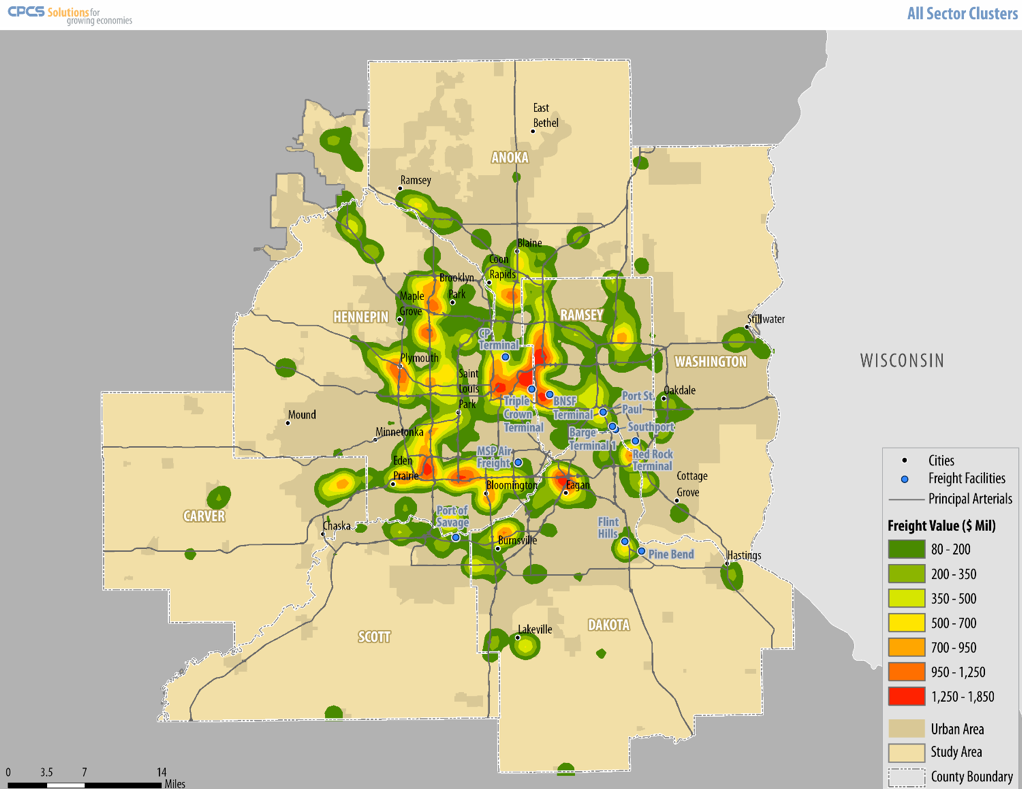
Freight value distribution in the Twin Cities region of Minnesota for the manufacturing sector